Hennepin County, Minnesota
| Hennepin County, Minnesota | ||
|
||
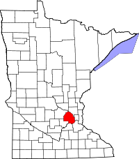 Location in the state of Minnesota |
||
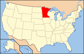 Minnesota's location in the U.S. |
||
| Founded | March 6, 1852 [1] | |
|---|---|---|
| Named for | Louis Hennepin, a Franciscan missionary, explorer, and author. | |
| Seat | Minneapolis | |
| Largest city | Minneapolis | |
| Area - Total - Land - Water |
606 sq mi (1,571 km²) 557 sq mi (1,442 km²) 50 sq mi (129 km²), 8.21% |
|
| PopulationEst. - (2008) - Density |
1,140,988 2,048/sq mi (774/km²) |
|
| Time zone | Central: UTC-6/-5 | |
| Website | www.hennepin.us | |
Hennepin County is a county located in the U.S. state of Minnesota, named in honor of the 17th-century explorer Father Louis Hennepin, a Belgian, working for the King of France. As of 2000 the population was 1,116,200; in 2008 the U.S. Census Bureau estimated its population to be 1,140,988.[1] Its county seat is Minneapolis. It is by far the most populous county in Minnesota; more than one in five Minnesotans live in Hennepin County. The center of population of Minnesota is located in Hennepin County, in the city of Rogers.[2]
Contents |
History
Hennepin County was created in 1852 by the Minnesota Territorial Legislature. Father Louis Hennepin's name was chosen because he originally named St. Anthony Falls and recorded some of the earliest accounts of the area for the Western world. Hennepin County's early history is closely linked to the establishment of the cities of Minneapolis and St. Anthony.[3]
Law and government
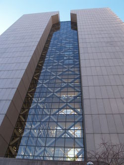
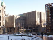
Like all counties in Minnesota, Hennepin is governed by an elected and nonpartisan board of commissioners. In Minnesota, county commissions usually have five members, but Hennepin, Ramsey, and St Louis counties have seven members. Each commissioner represents a district of equal population. In Hennepin the county commission appoints the medical examiner, county auditor-treasurer and county recorder. The sheriff and county attorney are also elected on a nonpartisan ticket. The county government's headquarters are in downtown Minneapolis in the Hennepin County Government Center. The county oversees the Hennepin County Library system, which merged with the Minneapolis Public Library system in 2008.
The county commission elects a chair who presides at meetings. Commissioners as of January 2009
| District | Commissioner | In office since | Current term expires in January |
|---|---|---|---|
| 1st | Mike Opat (chair) | 1993 | 2011 |
| 2nd | Mark Stenglein | 1997 | 2011 |
| 3rd | Gail Dorfman | 1999 | 2011 |
| 4th | Peter McLaughlin | 1991 | 2011 |
| 5th | Randy Johnson | 1979 | 2013 |
| 6th | Jan Callison | 2009 | 2013 |
| 7th | Jeff Johnson | 2009 | 2013 |
Key Staff
Hennepin County's normal operations are coordinated by the County Administrator Richard Johnson, Deputy County Administrator David Hough, Assistant County Administrator for Human Services and Public Health Dan Engstrom, and Assistant County Administrator for Public Works Marthand Nookala.
Geography
According to the U.S. Census Bureau, the county has a total area of 1,571 km² (606 mi²). 1,442 km² (557 mi²) of it is land and 129 km² (50 mi²) of it (8.21%) is water. The highest waterfall on the Mississippi River, the Saint Anthony Falls, discovered by Louis Hennepin, is in Hennepin County next to downtown Minneapolis, but in the 19th century, the falls were converted to a series of dams. Barges and boats now pass through locks to move between the parts of the river above and below the dams.
Major highways
|
|
Adjacent counties
- Anoka County (northeast)
- Ramsey County (east)
- Dakota County (southeast)
- Scott County (south)
- Carver County (southwest)
- Wright County (northwest)
 |
Wright County | Anoka County | |
|
| Ramsey County | ||||
| Carver County | Scott County | Dakota County |
National protected areas
- Minnesota Valley National Wildlife Refuge (part)
- Mississippi National River and Recreation Area (part)
Economy
Hennepin County has major economic centers in downtown Minneapolis and Bloomington.
Demographics
| Historical populations | |||
|---|---|---|---|
| Census | Pop. | %± | |
| 1860 | 12,849 |
|
|
| 1870 | 31,566 | 145.7% | |
| 1880 | 67,013 | 112.3% | |
| 1890 | 185,294 | 176.5% | |
| 1900 | 228,340 | 23.2% | |
| 1910 | 333,480 | 46.0% | |
| 1920 | 415,419 | 24.6% | |
| 1930 | 517,785 | 24.6% | |
| 1940 | 568,899 | 9.9% | |
| 1950 | 676,579 | 18.9% | |
| 1960 | 842,854 | 24.6% | |
| 1970 | 960,080 | 13.9% | |
| 1980 | 941,411 | −1.9% | |
| 1990 | 1,032,431 | 9.7% | |
| 2000 | 1,116,200 | 8.1% | |
| Est. 2008 | 1,140,988 | 2.2% | |
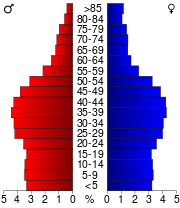
As of the census² of 2000, there were 1,116,200 people, 456,129 households, and 267,291 families residing in the county. The population density was 774/km² (2,005/mi²). There were 468,824 housing units at an average density of 325/km² (842/mi²). The racial makeup of the county was 80.53% White, 8.95% Black or African American, 1.00% Native American, 4.80% Asian, 0.05% Pacific Islander, 2.06% from other races, and 2.60% from two or more races. 4.07% of the population were Hispanic or Latino of any race. 22.8% were of German, 12.0% Norwegian, 7.6% Irish and 7.2% Swedish ancestry according to Census 2000. There were 456,129 households out of which 28.80% had children under the age of 18 living with them, 45.30% were married couples living together, 9.90% had a female householder with no husband present, and 41.40% were non-families. 31.80% of all households were made up of individuals and 8.40% had someone living alone who was 65 years of age or older. The average household size was 2.39 and the average family size was 3.07.
In the county the population was spread out with 24.00% under the age of 18, 9.70% from 18 to 24, 33.70% from 25 to 44, 21.70% from 45 to 64, and 11.00% who were 65 years of age or older. The median age was 35 years. For every 100 females there were 97.00 males. For every 100 females age 18 and over, there were 94.70 males.
The median income for a household in the county was $51,711, and the median income for a family was $65,985 (these figures had risen to $60,115 and $79,970 respectively as of a 2007 estimate[4]). Males had a median income of $42,466 versus $32,400 for females. The per capita income for the county was $28,789. About 5.00% of families and 8.30% of the population were below the poverty line, including 10.50% of those under age 18 and 5.90% of those age 65 or over.
Hennepin County is the wealthiest county in the state of Minnesota and one of the 100 Highest-income counties in the United States.
Cities and towns
| Cities | Townships | Unorganized | |
|---|---|---|---|
|
|
|
|
† While mostly in Hennepin County, the city extends beyond the county border.
‡ Located in another county, but a part of the city extends into Hennepin County.
Colleges and universities
- Augsburg College in Minneapolis
- Dunwoody College of Technology in downtown Minneapolis
- Hennepin Technical College in Brooklyn Park and Eden Prairie
- Minneapolis Community and Technical College in downtown Minneapolis
- Normandale Community College in Bloomington
- University of Minnesota, Twin Cities Campus in Minneapolis
Miscellaneous topics
Smoking ban
In May 2005, Hennepin County enacted a county-wide indoor smoking ban. Bar business depressed over the short run, as smokers went into neighboring counties to light up, but has since returned closer to normal, especially in the downtown Minneapolis clubs that are among the most popular live music venues in the state. In December, to great controversy, county officials responded to lobbying efforts from bar owners and returned smoking to bars located outside of Minneapolis, Bloomington and Golden Valley, which have their own municipal smoking bans. This was later superseded by the Minnesota statewide smoking ban.
Twins stadium
In August 2006, the Board voted 4-3 to levy a 0.15% sales tax within the county to fund the majority of the cost for a baseball stadium for the Minnesota Twins. Legislation passed by the Minnesota Legislature in the waning hours of the 2005-2006 session, and signed by Governor Tim Pawlenty, authorized the county to levy the tax without a voter referendum. It also created the Minnesota Ballpark Authority which will construct and manage the stadium on behalf of the county. The tax will be in effect for 30 years, with clauses allowing it to be increased by the board of commissioners.
References
- ↑ http://www.census.gov/popest/counties/CO-EST2008-popchg2000_2008.html
- ↑ Population and Population Centers by State: 2000
- ↑ JoEllen Haugo and Mary Jo Laakso (2001). "History of Minneapolis". Minneapolis Public Library. http://www.mpls.lib.mn.us/history/index.asp. Retrieved September 7, 2007.
- ↑ http://factfinder.census.gov/servlet/ACSSAFFFacts?_event=Search&geo_id=05000US48085&_geoContext=01000US%7C04000US48%7C05000US48085&_street=&_county=hennepin&_cityTown=hennepin&_state=04000US27&_zip=&_lang=en&_sse=on&ActiveGeoDiv=geoSelect&_useEV=&pctxt=fph&pgsl=050&_submenuId=factsheet_1&ds_name=ACS_2007_3YR_SAFF&_ci_nbr=null&qr_name=null®=null%3Anull&_keyword=&_industry=
External links
- Hennepin County Government website
- Hennepin County Library website
- Bloomington Convention & Visitors Bureau
|
||||||||||||||||||||